9.08.2012 – 9.08.2012 ![]() 28 °C
28 °C
We got going at our standard time and headed south towards the bridge that spans the Chesapeake Headlands. Before we had made it to the bridge I worked out that we had a dilemma. We’ve always had an issue of how were we going to zig zag across the country to allow us to see the Outer Banks of Nth Carolina and to see the Blue Ridge Parkway and Great Smoky Mountains (there are hundreds of miles separating the two). In my head we were always driving up from Williamsburg and across west to Shenandoah NP and from there down partway of the Blue Ridge parkway and then cutting back across either Virginia or Nth Carolina to see the Outer Banks and then snaking our way back west to see the Great Smokies.
 The only problem with my plan was that we therefore had to snake across Nth Carolina/ Virginia twice… which seems crazy… I spent my morning reading the guide books (whilst we were driving down towards the tip of Maryland) to try and work out the best method. I came to the conclusion that we would be better off to see the Outer Banks first and then go over to the Blue Ridge… Hmmm. We pulled over at a roadside stop and grabbed some food, brought in the maps and guide books and started to plan.
The problem with doing my plan would be that we would miss out on the middle of Nth and Sth Carolina… Was this going to be a problem? After much to-ing and fro-ing and general chit chat we all agreed to go see the Outer Banks first and then come back up into Virginia to see Williamsburg and the Appalachian Mountains.
Ok so back to the drive down the Md peninsular and over to Virginia. What I saw of the drive (which in fairness, til the bridge was almost none) we passed thru farms, farms and more farms! Which does surprise me considering how close we are to some of the biggest cities in the US. By the time we had made it to the bridge the landscape had changed back to marshy land with grey green grasses “blowing in the wind”. The bridge is pretty interesting because it is actually made up of three bridges and two tunnels. We think the tunnels are in place to ensure that ships can still get up the Chesapeake—and looking at the size of the ships parked in the bay they need plenty of clearance! It still blows me away to get on a bridge that goes for miles over water.. As far as I know, we just don’t have anything like it in Au..
 The other side of the bridge and you are in mainland Virginia (Virginia is also a part of the peninsular—not much though) and home to some of the more famous military landmarks in the US… Does Langley ring a bell? Its right here in Norfolk, Virginia- not that far from Jamestown, the first settlement of the USA (but I’ll get to that story in a couple of days time when we come back to this part of the world).
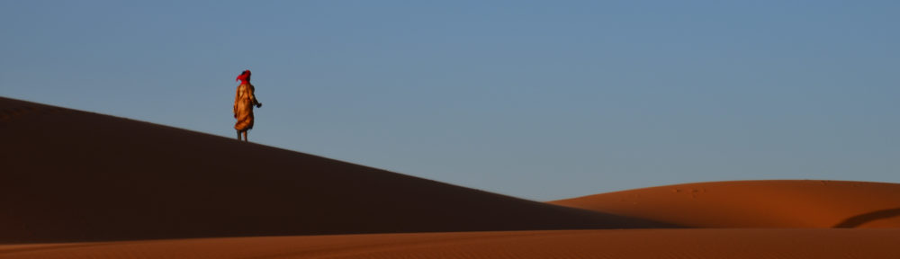
Another hour down the road (south east) and we had made it to Nth Carolina. By now we had been driving most of the day (it was after 3pm) and we still had quite a way to go to make it to the Outer Banks. We kept on going and arrived at about 5pm in the afternoon. What is the Outer Banks and why did we drive so hard to get here? The Outer Banks are a string of islands off the Nth Carolina shore that are home to thousands of sea birds and marine mammals and of course a tourist mecca. First appearance it reminded me quite a bit of northern Cape Cod. Houses lining the beach side perched on the sand hills, which are covered in the beautiful grey green grasses. It is a really pretty part of the world!
 We stopped in and found ourselves a hotel in Kitty Hawk, Nth Carolina, home of the Wright Bros first flight! We pulled in and immediately went for a walk along the beach. It’s a pretty warm afternoon so I was actually considering going for a swim…. That is until I felt the temp of the ocean!!! Woooeeee, it’s COLD!!! No kidding the water must be about 16 deg (or maybe cooler) way too cold for me to get in and get my feet wet!
Ok, so swimming was off the cards we decided to go for a walk along the beach. It’s a gorgeous afternoon for photography so I spent my time snapping photos of birdies flying around, kites being flown (this is the home of kite flying!) sand dunes… The sun was starting to set behind the sand dunes, the wind is blowing, the waves are gently rolling onto the sand (speaking of which, I asked someone if they ever get any surf on the Atlantic side because so far we haven’t seen any waves! none in Miami, none in Maine, none in Cape Cod, and now none in Nth Carolina!) the birds are wheeling overhead… Very picturesque and my sort of way to spend an afternoon!
Our evening was topped off with a yummy sausage sandwich bbq on the little porch off from our hotel room.. We had plenty of the neighbours come to visit to see what we were cooking!
Song of the Day– Don Henley, Boys of Summer
I note your comment about these “long” bridges in the US and I don’t want to brag but I hardly think it compares to the Ted Smout Memorial Bridge linking Sandgate to Redcliffe, at 2.7km it’s Au’s longest bridge! Right here in Maroon territory